


ALTO Voting District, Lee County, Illinois
About
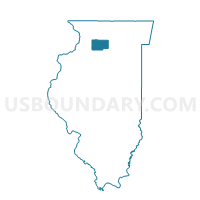
Outline

Summary
| Unique Area Identifier | 572616 |
| Name | ALTO Voting District |
| County | Lee County |
| State | Illinois |
| Area (square miles) | 34.94 |
| Land Area (square miles) | 34.90 |
| Water Area (square miles) | 0.04 |
| % of Land Area | 99.89 |
| % of Water Area | 0.11 |
| Latitude of the Internal Point | 41.84375730 |
| Longtitude of the Internal Point | -88.98929080 |
Maps


Graphs
Select a template below for downloading or customizing gragh for ALTO Voting District, Lee County, Illinois


Neighbors
Neighoring Voting District (by Name) Neighboring Voting District on the Map
- DEMENT Voting District, Ogle County, IL
- MALTA 2 Voting District, DeKalb County, IL
- MILAN 1 Voting District, DeKalb County, IL
- REYNOLDS Voting District, Lee County, IL
- SHABBONA 1 Voting District, DeKalb County, IL
- VIOLA Voting District, Lee County, IL
- WILLOW CREEK Voting District, Lee County, IL
Top 10 Neighboring County Subdivision (by Population) Neighboring County Subdivision on the Map
- Malta township, DeKalb County, IL (1,608)
- Shabbona township, DeKalb County, IL (1,453)
- Dement township, Ogle County, IL (989)
- Willow Creek township, Lee County, IL (688)
- Alto township, Lee County, IL (565)
- Viola township, Lee County, IL (351)
- Milan township, DeKalb County, IL (331)
- Reynolds township, Lee County, IL (297)
Top 10 Neighboring Place (by Population) Neighboring Place on the Map
Top 10 Neighboring Elementary School District (by Population) Neighboring Elementary School District on the Map
- Rochelle Community Consolidated District 231, IL (13,647)
- Creston Community Consolidated School District 161, IL (959)
- Steward Elementary School District 220, IL (626)
Top 10 Neighboring Secondary School District (by Population) Neighboring Secondary School District on the Map
Top 10 Neighboring Unified School District (by Population) Neighboring Unified School District on the Map
- DeKalb Community Unit School District 428, IL (52,734)
- Indian Creek Community Unit District 425, IL (4,690)
Top 10 Neighboring State Legislative District Lower Chamber (by Population) Neighboring State Legislative District Lower Chamber on the Map
Top 10 Neighboring State Legislative District Upper Chamber (by Population) Neighboring State Legislative District Upper Chamber on the Map
Top 10 Neighboring 111th Congressional District (by Population) Neighboring 111th Congressional District on the Map
Top 10 Neighboring Census Tract (by Population) Neighboring Census Tract on the Map
- Census Tract 9611, Ogle County, IL (5,184)
- Census Tract 18, DeKalb County, IL (4,002)
- Census Tract 9616, Ogle County, IL (3,554)
- Census Tract 1, Lee County, IL (2,967)
- Census Tract 3, DeKalb County, IL (2,680)